
Sources for Fountain Hills Neighbors
Block research starts with records organized around land, not people. The Maricopa County parcel map reveals the physical pattern. Assessor details add current ownership and mailing fields. Recorded plats and CC&Rs explain lots, tracts, and common rules. Voter data is a regulated source rather than a public street browser. Voluntary community lists can identify public contacts, but no official townwide resident roster was found.
| Block source | What it can show nearby | How to reach it |
|---|---|---|
| Assessor Parcel Viewer | Touching or near parcel shapes, subdivision context, parcel details | Free online; 1,000-feature display cap |
| Assessor property roll | Owner, situs and tax-mailing address, APN, deed link | Free current search |
| Recorded plat and CC&Rs | Lot and block layout, recorded association covenants | Recorder index, images, or copies |
| Voter file | Permitted fields within a bounded district, with protected voters removed | Recorder request, fee, and use limits |
| HOA or community source | Public board, management, business, or opt-in member contact | Association-specific policy |
An owner mailing address that matches the situs address supports possible owner occupancy, but does not prove it. A mismatch is a clue, not proof that no owner lives there. Trusts, estates, businesses, vacant parcels, and former parties can appear. Renters and other household members may not. Each result should be labeled with the exact link it has to the block.
Map Fountain Hills Neighbor Parcels
The Assessor Parcel Viewer can turn one address into a reproducible block sample. Begin with the standardized address or APN. An APN is the county's parcel number. Confirm the feature panel's situs address, then zoom until lot lines are clear. The map is a reference tool, not a legal survey.
- Open Search By and locate the subject parcel by address or APN. Confirm the situs and parcel number in Feature Information.
- Choose the parcel layer. Draw an Extent or Polygon over the visible block, or draw a Line and add a buffer for both sides of a short street segment.
- Use Create New Results first. Add or remove parcels to account for corners, alleys, common tracts, or nonresidential land.
- Open each result's Assessor detail and record the APN, ownership wording, and whether mailing and situs addresses differ.
- Use the subdivision and MCR link to reach the recorded map. MCR identifies the county map record tied to the plat.
GIS also supports Point, Polyline, Circle, and Freehand Polygon shapes. Optional buffers can widen a line or point. Results stop displaying after 1,000 features, so a tight block shape is more useful than a townwide query. Clicking a result zooms to the parcel and fills its feature details. For a longer named-street chain, use the Fountain Hills street directory method instead.
Read Fountain Hills Block Plats
A block makes more sense after its subdivision and MCR are known. Search the Maricopa County Recorder for the plat, then match lot and block labels to the parcel map. The legal description is the durable bridge when a street label differs or a parcel has split. CC&Rs can document recorded covenants and association governance, but they do not prove a current household list.
Names such as Eagle Mountain, Firerock, SunRidge Canyon, Lakeside Village, Bainbridge, and Golden Eagle matter in Fountain Hills research. A familiar neighborhood name may span several recorded subdivisions, while one platted development may not match the boundary a resident has in mind. Use the recorded plat for lot geometry and the association itself for current policy.
Recorder party roles need care. A declarant may have created restrictions, while a trustee or association may appear for a later filing. Search the subdivision or HOA name through the Business Name field, then narrow by document code and date. An unofficial image can be read online. Order an official or certified copy only when the task calls for authenticated text.
Contact Fountain Hills Community Groups
Community records form an opt-in layer around the public parcel base. No authoritative Town umbrella directory for neighborhood associations was located. HOA existence and policy must be checked through recorded CC&Rs and then with the association. Public material usually identifies board or management contacts, not all residents.
Eagle Mountain
Confirm the exact recorded subdivision and governing documents through the Recorder before seeking the current association contact.
Firerock
Use parcel and plat data to identify the applicable association. Ask that body what, if any, contact information it makes public.
SunRidge Canyon
Separate the neighborhood label from each recorded plat. Voluntary or member data follows the group's own access rules.
Townwide leads
The Chamber, River of Time Museum, clubs, congregations, and block-watch groups offer public or historical contacts, not a full resident roll.
Fountain Hills Library and the River of Time Museum share the Centennial Circle area. The library can open county research resources; the museum may hold donated photographs or oral histories under its own policy. Chamber entries name member businesses. Club, congregation, veteran, and watch rosters remain private unless the group has chosen to publish them.
Fountain Hills Neighbors and Voter Data
Arizona voter information cannot be turned into an open block browser. My.Arizona.Vote is meant for a voter to retrieve personal status through identity checks. Maricopa County's VM51 files are requested for a bounded district such as a precinct or county area, and access is limited by A.R.S. §16-168. Fields may include name, registration date, addresses, party, phone, status, an early-voting indicator, and participation history. Ballot choices are never shown.
The official A.R.S. §16-168 voter-information rules are captured below. The statute governs permitted use, fees, and redistribution, so it belongs in the workflow before any file request.
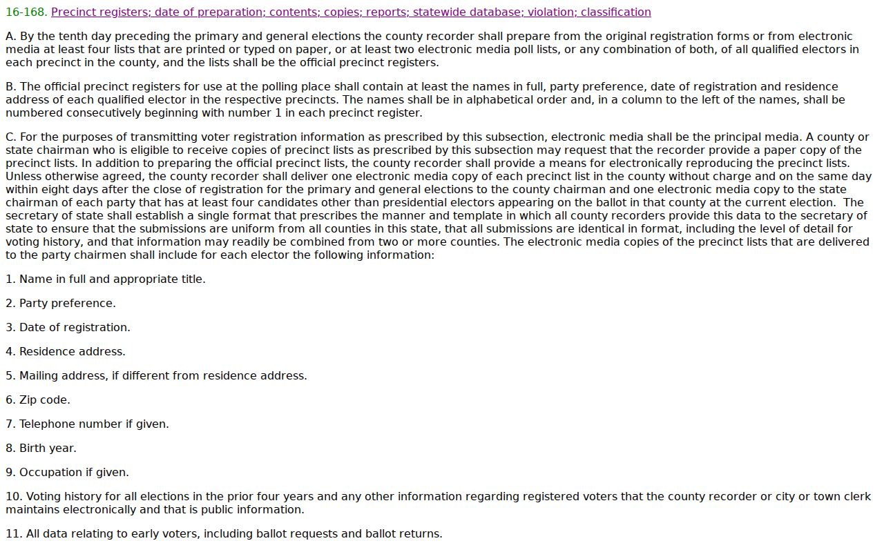
A registration address is evidence as of an effective date, not proof of present occupancy. Status can change after a move or notice. County request channels include the online portal, a PDF by email or fax, and inspection by appointment. Electronic delivery may use TXT, CSV, XLS, or PDF through a secure link and separate password.
Protected Fountain Hills Neighbors
A.R.S. §16-153 removes protected voters from disclosed registration material. Arizona's Address Confidentiality Program separately provides a substitute lawful address and mail forwarding for qualifying survivors. These safeguards are meant to prevent public records from exposing a person at risk.
The protected-voter statute appears in the successful capture below. Its role is simple but vital: a block list drawn from voter data is incomplete by design.
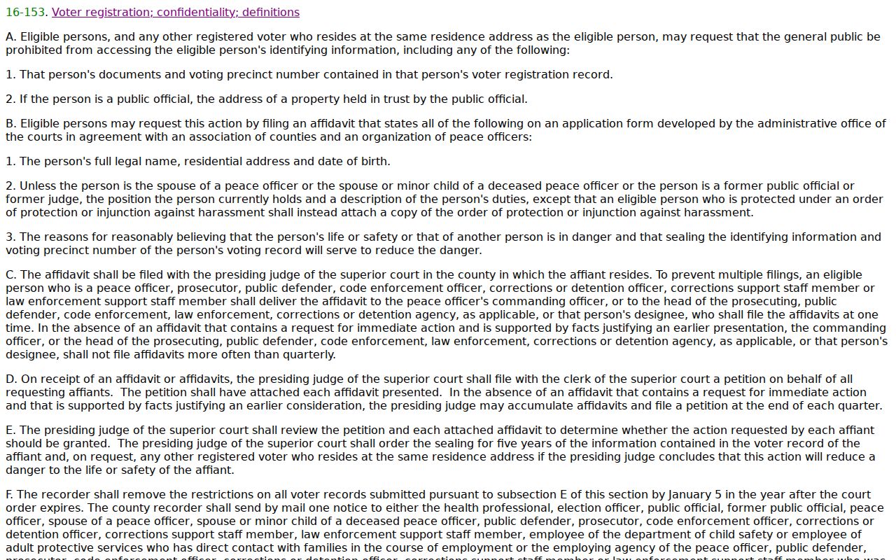
Do not try to fill that gap with utility, delivery, motor-vehicle, or private roster data. Some missing addresses reflect lawful protection, while other absences reflect renters, household members not on a deed, or a source that has not yet updated.
Compare Fountain Hills Neighbor Sources
Official records and commercial neighbor tools serve different roles. The official source states its custodian, date, field meaning, and access limit. A commercial compilation may blend many feeds, hide the source date, merge people, or carry an old address. Neither source should be stretched beyond what it proves.
| Source type | Best use | Main caution |
|---|---|---|
| Assessor and GIS | Map parcels and identify current owners of record | Owner is not the same as every occupant |
| Recorder plat | Confirm lots, blocks, legal descriptions, and recorded covenants | Not a current resident roster |
| Purpose-limited voter file | Use permitted fields for a lawful statutory purpose | Protected people omitted; no vote choices |
| Commercial compilation | Possible lead to be checked elsewhere | Stale dates and merged identities |
When a nearby name leads to a public federal case, confirm it only in the official docket. The PACER service supplies federal case locators and District of Arizona documents under its current fee policy.
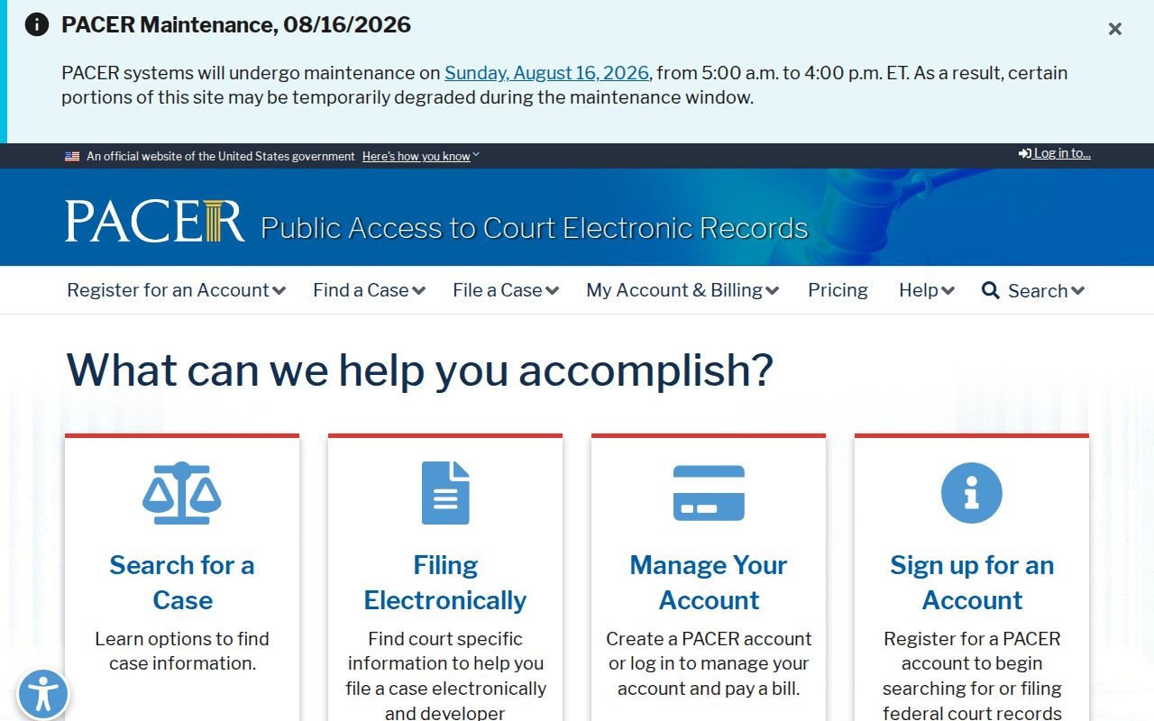
The image shows the official federal access point, not a neighbor directory. A court name match needs a case number, court, date, and role before it can be linked to the same person.
Place Fountain Hills Neighbors in Time
Fountain Hills is a planned community that incorporated in 1989. Earlier block research often shifts from a modern address to a subdivision plat, legal description, section-township-range, or county planning file. Municipal boundaries and postal wording may change which custodian holds a record without changing the land itself.
No verified standalone Fountain Hills reverse-directory run, townwide HOA directory, Sanborn sheet, or street-renumbering schedule was found. For past households, combine county deeds and plats with regional directories, released census schedules, newspapers, and local historical collections. Keep the evidence dated and never treat a present street number as though it existed in every era.
That timeline also changes the office path. Post-incorporation permits, planning files, council records, and code material may belong to the Town Clerk. Earlier development evidence is more likely to sit in county plats, deeds, assessment rolls, and planning records. Search the modern parcel first, preserve every APN and legal description found, and follow those stable land clues back through the jurisdictional handoff. A later street address should not be forced onto an older tract that was indexed only by subdivision or survey terms.
Limits on Fountain Hills Neighbor Lookups
A parcel-based block survey will miss three key groups: renters not named on the ownership roll, household members absent from the deed, and protected residents whose real address is withheld or replaced. It can also overcount trusts, corporate owners, estates, tax-mail recipients, vacant parcels, and former parties. Real-time household composition, minor children, utility customers, delivery data, and private group rosters do not belong in a public neighbor lookup.
Use a source to answer only its own question. GIS answers where a parcel lies. The Assessor answers who owns it for tax purposes. The Recorder answers which instrument was filed. A voluntary group answers what it has chosen to publish. If the goal is simply to meet the people next door, direct and respectful contact is more current than a record trail.
Lawful use. Fountain Hills block research must stay personal and respectful. Arizona law can punish stalking, harassment, threats, and misuse of protected data.